
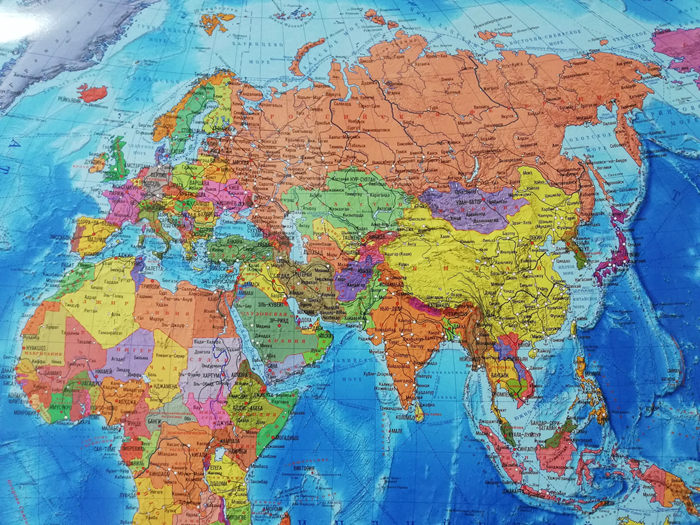
A political map is more than just a depiction of borders, but a complex analytical product reflecting geopolitical reality.
Teams of cartographers, political scientists, geoinformaticians, and editors work on its creation, processing data from official sources such as the UN, national statistical services, and diplomatic missions. The process includes verifying borders, accounting for disputed territories, and updating the names of states and capitals. To view maps on EasyMap, a specialized resource, simply select the region of interest—modern platforms offer interactive layers, historical comparisons, and granularity down to the administrative level.
Creation Methodology and Sources of Current Information
The development of a political map begins with the collection of primary data. Cartographers analyze international treaties, UN Security Council resolutions, decisions of the International Court of Justice, and official government publications. Particular attention is paid to disputed territories: such zones are marked with special markings (shading, dotted lines, color-coded markings) to reflect the ambiguity of status without compromising neutrality.
The main stages of map creation are:
- Geopolitical audit: monitoring border changes, name renaming, and the emergence of new states.
- Geodetic referencing: using satellite imagery and the WGS84 coordinate system for precise positioning.
- Visual design: selecting a color palette, fonts, and symbols to ensure readability and aesthetics.
- Digital adaptation: preparing vector layers for web maps with zooming and filtering capabilities.
- Expert verification: coordinating with political scientists and regional experts to eliminate factual errors.
Modern political maps are often integrated with economic, demographic, and military data, creating a multidimensional analytical environment. Interactive platforms allow users to customize the display: show only recognized states, highlight members of international organizations, or track the dynamics of territorial changes over decades.
Who creates the maps
The actual creation of finished maps is the work of specialists called cartographers. They analyze data and use computer programs to create images, which are then released electronically or in print.
An important aspect is neutrality: professional mapping services adhere to the de facto principle, reflecting actual control over territories, but with reservations about international recognition. This is especially relevant for regions with frozen conflicts or unrecognized entities.